


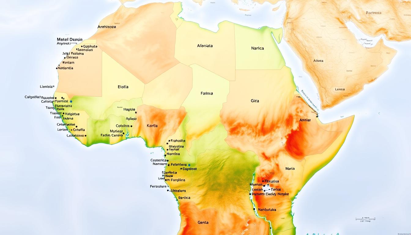
Exploring the African continent has never been easier, thanks to a detailed and comprehensive map that includes country labels. This valuable resource is perfect for students, travelers, and anyone interested in learning more about Africa’s geography.
With 54 countries to discover, a labeled map provides a clear visual representation of Africa’s diverse geographical layout. Whether you’re planning a trip or studying for a geography exam, this map is an essential tool.
Having a comprehensive map of Africa with country labels at your fingertips can enhance your understanding of the continent’s complex geography and make your educational or travel experiences more enjoyable and informative.
Key Takeaways
- A detailed map of Africa is crucial for educational purposes and travel planning.
- The map includes 54 countries, providing a comprehensive view of the continent.
- Country labels on the map enhance the understanding of Africa’s geographical layout.
- This resource is beneficial for students and travelers alike.
- A labeled map of Africa can make learning more engaging and fun.
The African Continent: An Overview
Africa, the cradle of humanity, is a vast and diverse continent that has captivated the imagination of travelers and scholars alike for centuries. As the second-largest continent globally, it covers approximately 30 million square kilometers, accounting for about 20% of the Earth’s total land area.
Africa’s Global Position and Size
Africa is positioned in the center of the globe, with its northern tip extending into the Mediterranean region and its southernmost point reaching towards Antarctica. The continent is bounded by the Mediterranean Sea to the north, the Atlantic Ocean to the west, the Indian Ocean to the southeast, and the Red Sea to the northeast. Its vast size and strategic location make it a crucial player in global affairs.
Geographical Diversity of the Continent
The geographical diversity of Africa is one of its most striking features. From the vast Sahara Desert in the north to the lush rainforests of the Congo Basin, and from the snow-capped mountains of Ethiopia to the Cape of Good Hope at its southern tip, Africa’s landscapes are as varied as they are breathtaking. As noted by a geographer, “Africa’s diverse geography has shaped the course of human history, influencing the development of cultures, economies, and ecosystems across the continent.”
The continent is also home to numerous rivers, including the Nile, the Congo, and the Niger, which have supported human civilization for millennia. Africa’s geographical diversity is not just a natural wonder but also a foundation for its rich cultural heritage and economic potential.
Map of Africa with Names: Understanding the Basics
Understanding Africa begins with a look at its map. The continent’s diverse geography, rich history, and cultural heritage are all intricately linked, and a map provides a visual representation of these elements. A comprehensive map of Africa featuring country labels is essential for students, travelers, and anyone interested in the continent.
Evolution of African Cartography
The history of cartography in Africa is as old as the continent itself. From ancient civilizations to modern times, the art of map-making has evolved significantly. Early maps were often inaccurate and based on limited knowledge, but with exploration and colonization, more precise maps were created. Today, with the advent of digital technology and satellite imaging, cartography has become more accurate and accessible.
Types of African Maps and Their Uses
There are various types of maps, each serving a different purpose. Political maps highlight country borders and capitals, while physical maps show geographical features like mountains and rivers. Thematic maps focus on specific data, such as population density or climate zones. Understanding the different types of maps and their uses is crucial for effectively utilizing them in education, travel, and research.
Importance of Accurate Country Labeling
Accurate country labeling on a map is vital for several reasons. It helps in identifying countries and their capitals, understanding regional dynamics, and facilitating navigation. Inaccurate labeling can lead to confusion and misinformation. With the increasing importance of geographical knowledge in today’s interconnected world, the accuracy of country labeling on maps has become more critical than ever.
The Five Regions of Africa
Africa’s vast and varied landscape is often segmented into five regions, providing a framework for exploring its many countries and cultures. This division helps in understanding the diverse geographical, cultural, and historical contexts that exist across the continent.
North Africa
North Africa is characterized by its vast deserts, including the Sahara, and countries such as Egypt, Libya, and Morocco. The region is known for its rich history, including ancient civilizations like the Egyptians and the Berbers.
West Africa
West Africa is a region of diverse cultures and languages, with countries like Nigeria, Ghana, and Senegal. It is known for its vibrant music and dance, as well as its historical empires such as the Mali and Songhai.
Central Africa
Central Africa includes countries like the Democratic Republic of Congo, Cameroon, and Gabon. The region is known for its dense rainforests and diverse wildlife, as well as its complex history and cultural diversity.
East Africa
East Africa is home to countries such as Kenya, Tanzania, and Ethiopia. The region is known for its savannas, mountains, and the Great Rift Valley, as well as its diverse cultures and historical sites.
Southern Africa
Southern Africa includes countries like South Africa, Namibia, and Botswana. The region is known for its diverse landscapes, from deserts to coastlines, and its rich cultural heritage.
| Region | Notable Countries | Key Features |
|---|---|---|
| North Africa | Egypt, Libya, Morocco | Sahara Desert, ancient civilizations |
| West Africa | Nigeria, Ghana, Senegal | Diverse cultures, historical empires |
| Central Africa | DRC, Cameroon, Gabon | Dense rainforests, diverse wildlife |
| East Africa | Kenya, Tanzania, Ethiopia | Savannas, Great Rift Valley, diverse cultures |
| Southern Africa | South Africa, Namibia, Botswana | Diverse landscapes, rich cultural heritage |
The division into these five regions helps in understanding the complexity and diversity of the African continent. Each region has its unique characteristics, contributing to the rich tapestry that is Africa.

North African Countries and Their Borders
North Africa, a region of immense historical and cultural significance, is home to diverse countries with complex borders. The region’s geography has played a crucial role in shaping its history and cultural identity.
Egypt and Sudan: The Nile Nations
Egypt and Sudan are two countries in North Africa that share a common border along the Nile River. The Nile has been the lifeblood of both nations, supporting ancient civilizations and modern agriculture.
The Maghreb: Morocco, Algeria, Tunisia, and Libya
The Maghreb region, comprising Morocco, Algeria, Tunisia, and Libya, has a distinct cultural identity shaped by its history and geography. These countries share cultural and historical ties, despite their individual differences.
Geographical Features of North Africa
North Africa is characterized by diverse geographical features, including the Sahara Desert, the Atlas Mountains, and the Nile River. These features have influenced the region’s climate, economy, and population distribution.
| Country | Capital | Population (millions) |
|---|---|---|
| Egypt | Cairo | 100 |
| Sudan | Khartoum | 40 |
| Morocco | Rabat | 36 |
West African Nations on the Map
West Africa is a region of diverse cultures, languages, and geography, spanning from the Atlantic coast to the Sahara Desert. This diversity is reflected in its various countries, each with its unique characteristics.
Coastal West Africa: Senegal to Nigeria
The coastal countries of West Africa, from Senegal to Nigeria, are significant economic hubs. They are characterized by bustling ports and a rich cultural heritage.
Inland West African States: Mali, Niger, and Burkina Faso
Inland states like Mali, Niger, and Burkina Faso have their own historical and geographical significance. They are known for their ancient trade routes and diverse ethnic groups.
Economic Centers and Capital Cities
West Africa’s economic centers and capital cities play a crucial role in the region’s development. Cities like Dakar, Accra, and Lagos are major economic hubs.
| Country | Capital | Main Economic Activity |
|---|---|---|
| Senegal | Dakar | Trade and Tourism |
| Mali | Bamako | Agriculture and Mining |
| Nigeria | Abuja | Oil Production and Agriculture |
Central African Countries and Their Locations
Central Africa, a region of vast geographical diversity, is home to numerous countries with unique cultural and environmental characteristics. The region’s complex geography is dominated by the vast expanse of the Congo Basin, which is the second-largest tropical rainforest in the world.
The Congo Basin Nations
The Congo Basin encompasses several countries, including the Democratic Republic of the Congo, the Republic of the Congo, Cameroon, Equatorial Guinea, and Gabon. These nations are characterized by dense rainforests, significant waterways, and a rich biodiversity.
As noted by the World Wildlife Fund, “The Congo Basin is one of the most important biodiversity hotspots on the planet, with a vast array of flora and fauna, many of which are found nowhere else on Earth.”
| Country | Capital | Population (millions) |
|---|---|---|
| Democratic Republic of the Congo | Kinshasa | 92 |
| Republic of the Congo | Brazzaville | 5.5 |
| Cameroon | Yaoundé | 25 |
Cameroon, Chad, and Central African Republic
Cameroon, Chad, and the Central African Republic are other key countries in Central Africa, each with its own unique geographical features. Cameroon is known for its diverse ecosystems, ranging from coastal areas to mountains. Chad is characterized by its arid landscapes, while the Central African Republic has a mix of savannas and forests.
Navigating Central Africa’s Complex Geography
Navigating the complex geography of Central Africa presents several challenges, including dense forests, vast rivers, and limited infrastructure in some areas. However, this complex geography also offers opportunities for sustainable development, such as eco-tourism and conservation efforts.
The region’s geography has also influenced the cultural and economic activities of its inhabitants, with many communities relying on the natural resources available to them.
East African Nations and the Horn of Africa
With its rich history and diverse landscapes, East Africa stands out as a significant region within the African continent. The region encompasses a variety of countries, each contributing its unique cultural, historical, and geographical characteristics.
Kenya, Tanzania, and Uganda: The East African Community
The East African Community, comprising Kenya, Tanzania, and Uganda, is a significant economic and cultural bloc in the region. These countries share historical ties and have worked together on various economic initiatives. Key features include:
- Kenya’s diverse landscapes, from savannas to mountains
- Tanzania’s vast wilderness areas, including the Serengeti
- Uganda’s rich cultural heritage and diverse wildlife
Ethiopia, Somalia, and Eritrea: The Horn of Africa
The Horn of Africa, which includes Ethiopia, Somalia, and Eritrea, is a region of significant historical and cultural importance. Each of these countries has its own distinct identity and challenges. Notable aspects include:
- Ethiopia’s ancient history and cultural heritage
- Somalia’s extensive coastline along the Indian Ocean
- Eritrea’s unique blend of African and Italian influences
The Great Lakes Region and East African Rift Valley
The Great Lakes Region and the East African Rift Valley are significant geographical features of East Africa. The region is home to some of Africa’s most notable lakes, including Lake Victoria and Lake Tanganyika. The Rift Valley is not only a geological wonder but also a region of great biodiversity.
Southern African Countries and Their Boundaries
With its rich history and varied geography, Southern Africa stands out as a significant region within the African continent. The region is characterized by diverse landscapes, ranging from deserts to savannas, and is home to several countries with complex boundaries.
South Africa, Namibia, and Botswana
South Africa, known for its vibrant cities and wildlife, shares borders with Namibia, Botswana, and other neighboring countries. Namibia’s vast desert landscapes and Botswana’s Okavango Delta are notable geographical features.
- South Africa’s diverse ecosystems
- Namibia’s unique desert landscapes
- Botswana’s pristine wilderness areas
Zimbabwe, Zambia, and Mozambique
Zimbabwe and Zambia are known for their natural wonders, including Victoria Falls, one of the world’s largest waterfalls. Mozambique, with its extensive coastline, offers a mix of cultural and natural attractions.
“Victoria Falls is a testament to the awe-inspiring power of nature.”
Geographical Highlights of Southern Africa
The region boasts diverse geographical highlights, from the Kalahari Desert to the Drakensberg Mountains. These features not only attract tourists but also play a crucial role in the regional ecosystem.
Island Nations of Africa
Off the eastern coast of Africa lies a series of island nations with rich histories and diverse cultures. These islands, while often overshadowed by the vast mainland, possess unique geographical features and strategic importance.
Madagascar: The Giant of African Islands
Madagascar is the largest island nation off the coast of Africa, known for its unique wildlife and diverse ecosystems. The island’s distinct flora and fauna have evolved in isolation, making it a hotspot for biodiversity.
Smaller Island Nations: Seychelles, Mauritius, and Comoros
Seychelles, Mauritius, and Comoros are smaller island nations that boast stunning beaches and vibrant cultures. Seychelles is renowned for its coral reefs, while Mauritius is known for its luxury tourism. Comoros, with its volcanic landscapes, offers a different island experience.
The Strategic Importance of African Island Nations
These island nations are not just tourist paradises; they also hold strategic importance due to their locations in the Indian Ocean. They play significant roles in regional maritime security and trade.
Historical Context of African Borders and Names
Understanding the historical context of African borders requires a deep dive into the continent’s past, including pre-colonial territories and colonial influences. The borders and names of African countries have a complex history that has been shaped by various factors.
Pre-Colonial African Territories
Before the advent of colonialism, Africa was home to numerous territories and empires, each with its own distinct identity and boundaries. These pre-colonial territories played a significant role in shaping the modern borders of African countries.
Colonial Influence on Modern African Boundaries
The colonial era saw the redrawing of African borders by European powers, often with little regard for existing ethnic, linguistic, or cultural divisions. This legacy continues to influence the modern boundaries of African countries.
Post-Independence Border Changes and Disputes
Following independence, many African countries experienced border disputes and changes, often as a result of the artificial boundaries imposed during colonial times. These disputes continue to affect regional stability and cooperation.
| Region | Pre-Colonial Territories | Colonial Influence | Post-Independence Changes |
|---|---|---|---|
| North Africa | Ancient Egyptian and Berber territories | French and Italian colonial rule | Border disputes between Morocco and Western Sahara |
| West Africa | Empires of Ghana, Mali, and Songhai | British, French, and Portuguese colonial rule | Border tensions between Nigeria and Cameroon |
| East Africa | Kingdoms of Ethiopia and Buganda | British, Italian, and German colonial rule | Border disputes between Ethiopia and Eritrea |
Digital Resources for Exploring Maps of Africa
In today’s digital landscape, exploring the vast and diverse continent of Africa has become more accessible than ever. The wealth of digital resources available today makes it easier for travelers, students, and geography enthusiasts to delve into the intricacies of Africa’s geography.
Online Interactive Maps of Africa
Online interactive maps offer a dynamic way to explore Africa. Platforms like Google Maps and specialized geographical websites provide detailed maps that can be zoomed in and out, offering insights into various geographical features, political boundaries, and cultural landmarks. “The use of interactive maps in education has been a game-changer,” notes a geography educator. “It makes learning more engaging and interactive.”
Mobile Apps for African Geography
Mobile apps have further simplified the process of learning about African geography. Apps like GeoGuessr and Maps.me allow users to navigate through Africa’s diverse landscapes virtually. These apps are not only educational but also provide practical information for travelers.
Educational Resources for Learning African Countries
For students and educators, there are numerous educational resources available. Websites like National Geographic Kids and educational platforms offer interactive quizzes, games, and detailed maps that make learning about Africa fun and engaging. As emphasized by a educational specialist, “Using digital resources in the classroom enhances the learning experience and fosters a deeper understanding of global geography.”
From Maps to Adventures: Planning Your African Journey
With a comprehensive understanding of Africa’s geography and maps, travelers can begin planning their African journey. Whether it’s a safari, a cultural tour, or an adventure in the great outdoors, using the information gained from the map is crucial for a successful trip.
Effective travel planning involves researching destinations, understanding the climate and geography, and identifying key attractions. By familiarizing yourself with the regions and countries of Africa, you can create an itinerary that suits your interests and travel style.
Consider the diverse landscapes and cultures that Africa has to offer. From the savannas of East Africa to the deserts of North Africa, each region provides a unique experience. Planning your journey around these geographical features can enhance your travel experience.
To make the most of your trip, utilize online resources and travel guides that provide detailed information on African countries and their attractions. This will help you navigate the continent with ease and make informed decisions about your travel plans.
FAQ
What is the importance of having a detailed map of Africa with country labels?
A detailed map of Africa with country labels is essential for educational purposes, travel planning, and understanding the geographical layout of the continent.
How many countries are there in Africa?
There are 54 countries in Africa, each with its unique cultural, geographical, and historical characteristics.
What are the different types of maps of Africa available?
There are various types of maps of Africa, including physical maps, political maps, and thematic maps, each serving a different purpose and providing distinct information.
How has cartography evolved over time, and what impact has it had on our understanding of Africa?
Cartography has evolved significantly, from traditional paper maps to digital maps and GPS technology, making it easier to navigate and understand the African continent.
What are the five regions of Africa, and how are they characterized?
Africa is typically divided into five regions: North Africa, West Africa, Central Africa, East Africa, and Southern Africa, each with its unique cultural, geographical, and historical characteristics.
What are some of the geographical features that define the different regions of Africa?
The regions of Africa are defined by various geographical features, including deserts, mountains, coastlines, and rivers, which shape the climate, culture, and economy of each region.
How can I use a map of Africa to plan my trip?
A map of Africa can help you plan your trip by identifying the countries and regions you want to visit, understanding the geographical layout, and navigating the continent.
What are some digital resources available for exploring maps of Africa?
There are numerous digital resources available, including online interactive maps, mobile apps, and educational resources, which can be used to explore and understand the geography of Africa.
How have historical factors influenced the modern map of Africa?
Historical factors, including pre-colonial territories, colonial powers, and post-independence changes, have shaped the modern map of Africa, resulting in the country borders and names we see today.
What is the significance of island nations in Africa, such as Madagascar and Seychelles?
Island nations in Africa have their own unique cultural, geographical, and historical characteristics, and play a significant role in the regional economy and ecosystem.


